What happens when you shake a lake?
Learning about past earthquakes to prepare for future hazards
Ngā Ngaru Wakapuke research team / Lake Rotoiti community engagement
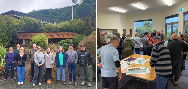
On a wet, wet Saturday in April, researchers from Ngā Ngaru Wakapuke sat down with local residents in the community hall in St Arnaud, Lake Rotoiti. The invitation had been to come for a public picnic and learn what our lakes can tell us about past earthquakes — and how that knowledge can help us prepare for future shakes. The weather had other ideas, but the community showed up anyway.
And they came with questions — the kind that matter most to people who live alongside the land and the lake and want to understand what it might do. Where is safe during a lake tsunami? How long should people stay away from the water after a shake?
Those who turn up to these events are often well-prepared and well-informed about local risks. One area that needs more attention, however, is information for visitors — day-trippers, Airbnb guests, and international travellers who have never thought about what a lake does when the ground moves. How do hosts and tourism providers communicate potential hazards? While some response group members are already thinking about their responsibility to people who might be in the area when disaster strikes, more research and clearer guidance are still needed.
Our thanks to the community for their engagement, curiosity and their time. Or as one local put it: "Thanks for talking with us and not at us."
***
Below are the information panels shown at the event and a short description.
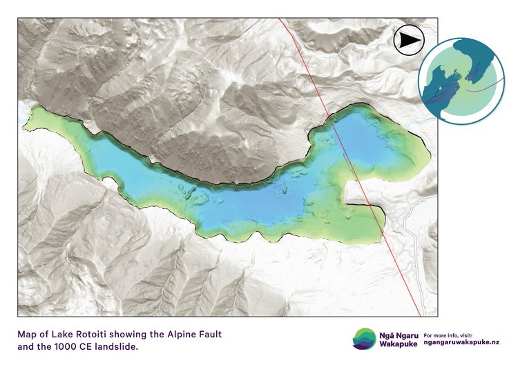
Beneath the calm surface of Lake Rotoiti lies a landscape shaped by earthquakes and landslides. The Alpine Fault (red line) cuts directly through the basin. The lumpy areas on the lake floor mark where huge landslides have plunged into the lake in the past. These events are rare in a human lifetime, but common over thousands of years.
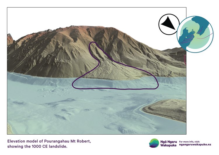
Around 1,000 years ago, a massive landslide broke away from Pourangahau / Mount Robert during a major Alpine Fault earthquake. As it crashed into the lake, it pushed a huge surge of water outward, creating a lake tsunami. This image shows the scar left behind on the hillside and the deposit on the lake bottom.
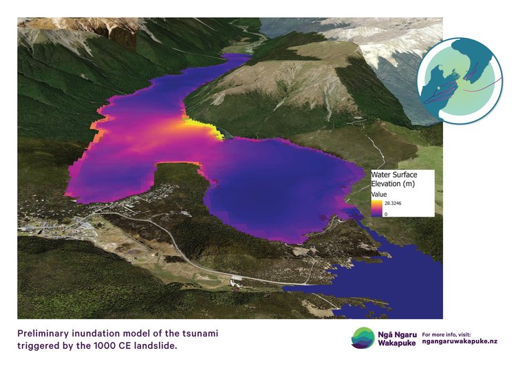
A computer model of the tsunami that raced across the lake after the Pourangahau / Mount Robert landslide. Near the source, waves may have reached almost 30 metres high, and around 5 metres at Kerr Bay. It gives us a window into what happened in the past, but also a reminder that future events may unfold differently.
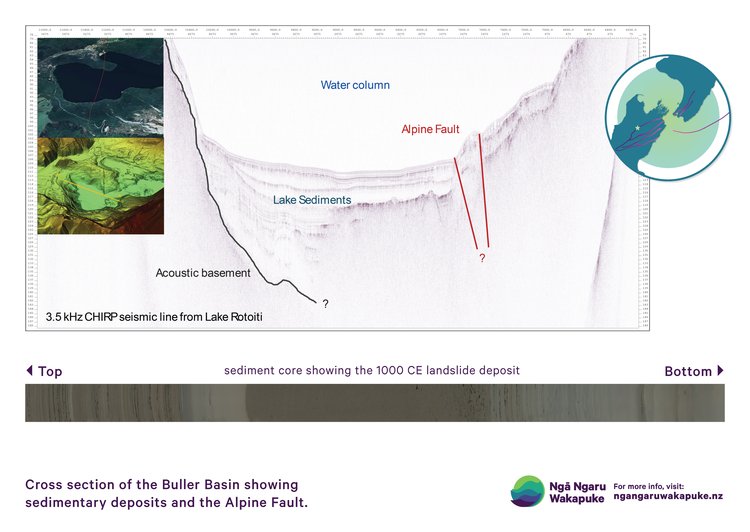
The history of these events is written in the mud beneath the lake. Layer by layer, sediments record earthquakes, landslides, and tsunamis over the last 17,000 years. By reading this record as shown from a core sample (at the bottom of the above image), we can work out how often these events happen and better understand the risks we face in the future.
There is more engagement to come around Lake Rotoiti as the science continues to progress.